Oryukdo Islets (Busan National Geopark) (오륙도 (부산 국가지질공원))
Oryukdo Islets (Busan National Geopark) (오륙도 (부산 국가지질공원))
 – Homepage
www.bsnamgu.go.kr
Oryukdo Islets consist of six rocky islets located in the sea at the southern end of Igidae Park, appearing as either five or six depending on the tide. The islets, closest to the mainland, are named Bangpaeseom Island, Solseom Island, Suriseom Island, Songgotseom Island, Gulseom Island, and Deungdaeseom Island, with only the Deungdaeseom Island accessible to visitors. From the Oryukdo Skywalk at Oryukdo Sunrise Park, visitors can enjoy even better views of the islets.
– Address : 137 Oryukdo-ro, Nam-gu, Busan
※ Presentation Information
– Information and Guides
Haeparang Trail Busan Tourist Information Center +82-51-607-6395
– Parking
Available
– Day Off
N/A (Open all year round)
– Operating Hours
Open 24 hr


◎ Nearby Tourism Infobox
⊙ Haeparang Trail Course 1 (해파랑길 1코스)
– Homepage
www.durunubi.kr
The first course of Haeparang Trail is a coastal road connecting Yongho-dong, Nam-gu and Jung 2-dong, Haeundae-gu in Busan, starting from Oryukdo Sunrise Park, passing Gwangallihaebyeon Beach and APEC Beach, to Mipo. Not only can visitors enjoy the sea cliffs and the natural scenery of the East Coast, but also the splendid and bustling Gwangalli and Haeundae tours.
⊙ Oryukdo Sunrise Park (오륙도해맞이공원)
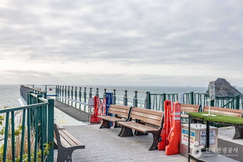
Oryukdo Sunrise Park, situated in the Yongho-dong area of Busan, offers a breathtaking view of the vast sea, especially in spring when the fields are covered with daffodils and canola flowers. Oryukdo Skywalk, a 15-meter-long glass bridge above the sea, provides the best view of Oryukdo Islets. This is also the place where the East Sea and the South Sea meet, known as Jallokgae or Seungdumal. Visitors can find a signboard below the skywalk marking the point where the east and south sea meet. From here, the Haeparang Trail stretches 770 kilometers along the East Sea and Namparang Trail stretches 1,463 kilometers along the South Sea.