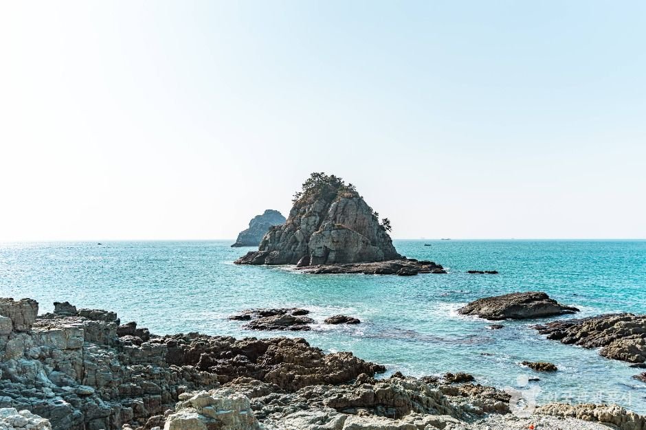
Namparang Trail (Busan)
Namparang Trail (Busan)
 – Homepage
www.visitbusan.net
The Namparang Trail, meaning “a path along the blue southern sea,” is a long-distance coastal trail consisting of 90 courses that stretch from Oryukdo Sunrise Park in Busan to the southernmost village of Haenam in Jeollanam-do. The trail offers a unique opportunity to experience a wide range of landscapes, including scenic coastlines, urban waterfronts, and the tranquil atmosphere of rural farming and fishing villages.
In Busan, Course 1 begins at Oryukdo Sunrise Park and continues to Choryang’s Shanghai Street. Course 2 passes through Yeongdo, while Course 3 connects Songdo Beach, Songdo Coastal Walkway, and Amnam Park. Course 4 starts at Dadaepo Beach, known for its wide sandy shore, and ends at Morundae at the far end of the beach. Course 5 begins at Eulsukdo Island, a well-known ecological site where visitors can observe diverse birdlife and natural habitats.
– Address : Yongho-dong, Nam-gu, Busan
※ Presentation Information
– Information and Guides
+82-51-607-4824
– Day Off
N/A (Open 24 hr)
– Operating Hours
Open all year round


◎ Nearby Tourism Infobox
⊙ Oryukdo Sunrise Park (오륙도해맞이공원)
View detailed guide on Korea Trip Guide →
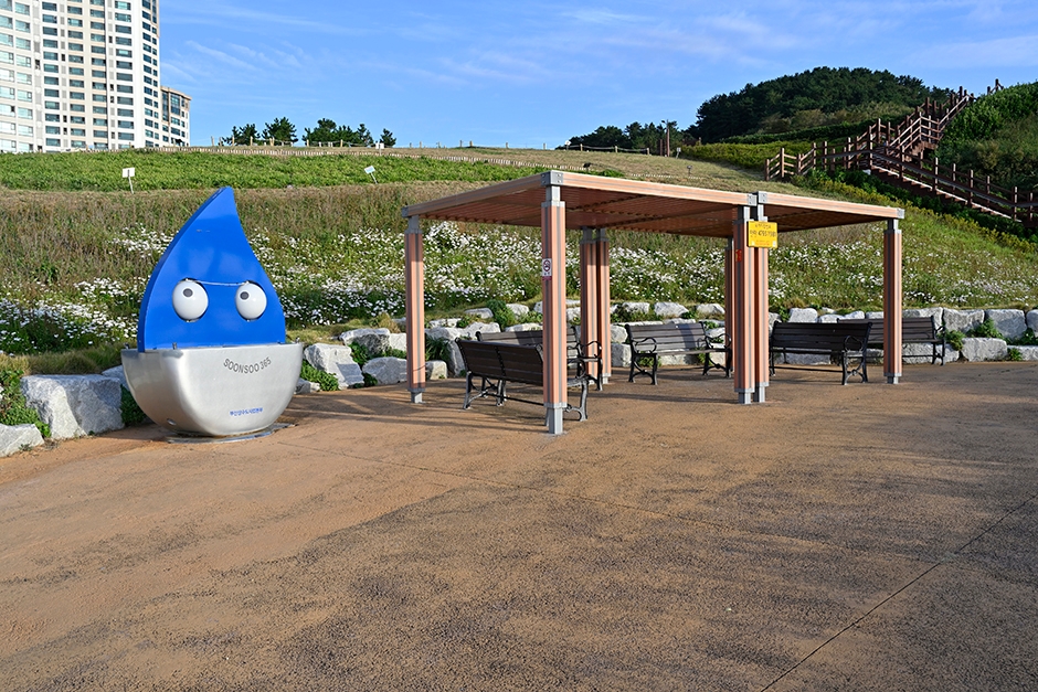
Oryukdo Sunrise Park, situated in the Yongho-dong area of Busan, offers a breathtaking view of the vast sea, especially in spring when the fields are covered with daffodils and canola flowers. Oryukdo Skywalk, a 15-meter-long glass bridge above the sea, provides the best view of Oryukdo Islets. This is also the place where the East Sea and the South Sea meet, known as Jallokgae or Seungdumal. Visitors can find a signboard below the skywalk marking the point where the east and south sea meet. From here, the Haeparang Trail stretches 770 kilometers along the East Sea and Namparang Trail stretches 1,463 kilometers along the South Sea.
⊙ Haeparang Trail Course 1 (해파랑길 1코스)
– Homepage
www.durunubi.kr
The first course of Haeparang Trail is a coastal road connecting Yongho-dong, Nam-gu and Jung 2-dong, Haeundae-gu in Busan, starting from Oryukdo Sunrise Park, passing Gwangallihaebyeon Beach and APEC Beach, to Mipo. Not only can visitors enjoy the sea cliffs and the natural scenery of the East Coast, but also the splendid and bustling Gwangalli and Haeundae tours.
⊙ Busan St Mary’s Hospital (부산성모병원)
View detailed guide on Korea Trip Guide →
Busan St. Mary’s Hospital, which is almost 20 years old, has 26 departments and 377 beds, with approximately 100 medical staff members and 700 employees.
The Specialized Pediatric Center provides differentiated medical services, with six pediatricians as well as specialists in urology, ophthalmology, orthopedics, surgery, rehabilitation medicine, and otolaryngology. The Hospice and Palliative Care Center, designated as a specialized palliative care institution by the Ministry of Health and Welfare in 2009, operates a hospice ward while providing home-based hospice care for patients who cannot be hospitalized.
In 2007, the hospital opened a sign language interpretation office, the first of its kind in Korea and the only one in Busan. Two professional sign language interpreters working at the office provide sign language interpretation services. Busan St. Mary’s Hospital is a leading medical institution in the community committed to providing optimum medical services to patients by understanding their needs.
⊙ Igidae Cliff [National Geopark] (이기대 (부산 국가지질공원))
View detailed guide on Korea Trip Guide →
– Homepage
www.busan.go.kr
Igidae Cliff is a geological park located along the southern coast of Busan. Formed by volcanic activity dating back 80 million years to the Cretaceous period, the accumulated lava, volcanic ash, and other rocks have been eroded by waves, creating cliffs, caves, and other formations. Along the coastal trail leading to Oryukdo, visitors can appreciate various geological and topographical landscapes, including copper mines and pothole.
![Van Ake – Lotte Department Store Centum City Branch [Tax Refund Shop] (반에이크 롯데백화점 센텀시티점)](https://ktrip.blogsailing.com/wp-content/uploads/2026/07/4044043_image2_1.jpg)
![Ferragamo – LOTTE Department Store Busan Main Branch [Tax Refund Shop] (페라가모 롯데백화점 부산본점)](https://ktrip.blogsailing.com/wp-content/uploads/2026/07/4018488_image2_1.jpg)
](https://ktrip.blogsailing.com/wp-content/uploads/2026/07/4018660_image2_1.jpg)
![Fendi – LOTTE Department Store Busan Main Branch [Tax Refund Shop] (펜디 롯데백화점 부산본점)](https://ktrip.blogsailing.com/wp-content/uploads/2026/07/4041903_image2_1.jpg)
](https://ktrip.blogsailing.com/wp-content/uploads/2026/07/4019905_image2_1.jpg)
](https://ktrip.blogsailing.com/wp-content/uploads/2026/07/4044052_image2_1.jpg)